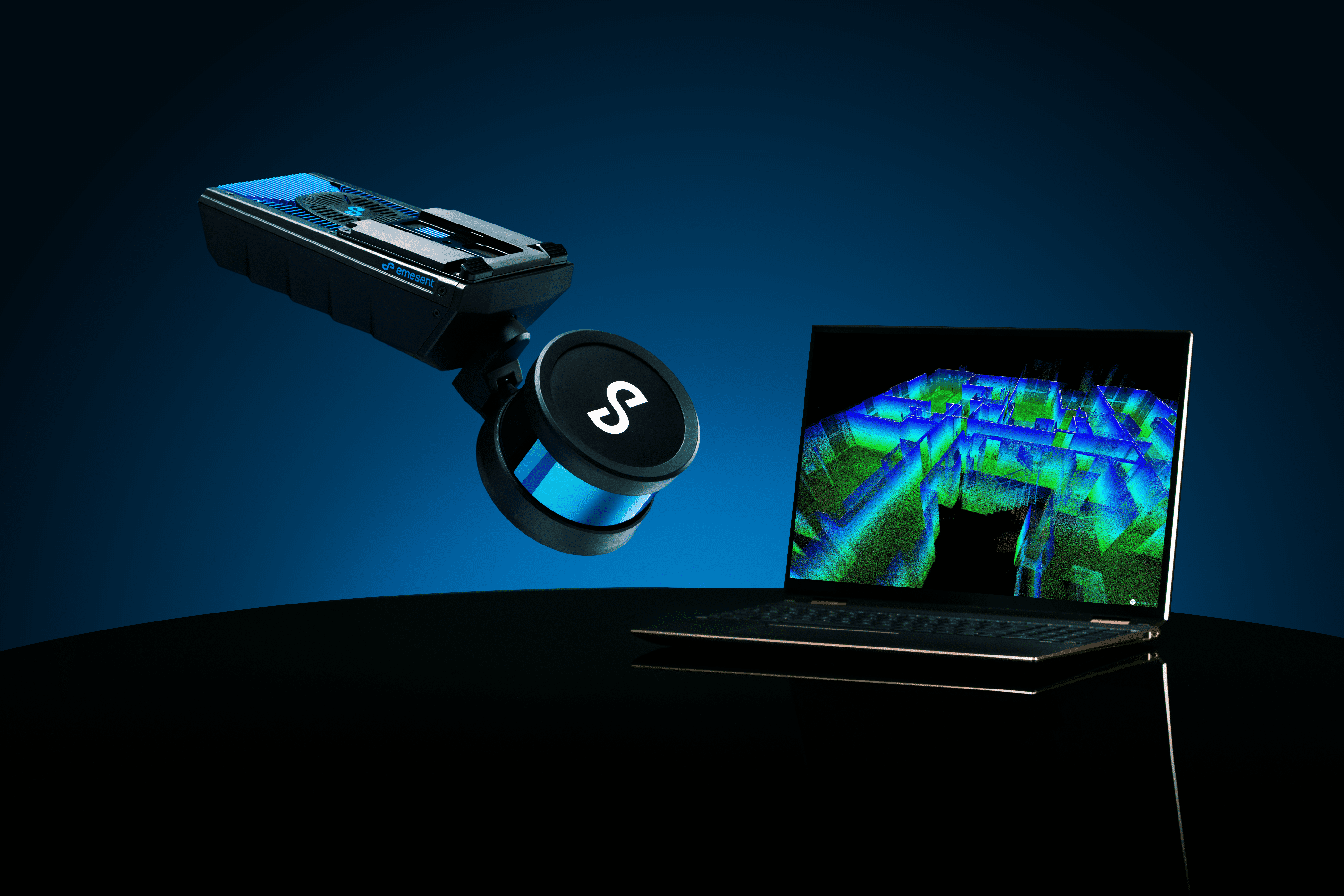
Offering a choice of smart mobile LiDAR scanning units, and its own visualization software, Hovermap provides fast, detailed, and autonomous mapping for challenging, inaccessible environments. Hovermap can be mounted to a drone or robot or easily switched to handheld, backpack, vehicle, or pole-mounted scanning. Equally capable above ground or underground, indoors or out, Hovermap provides the versatility needed to capture real-time data anywhere.
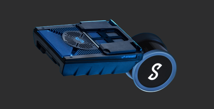
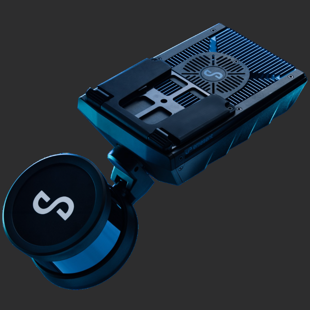
Featuring the industry-leading capabilities of Hovermap ST at its core, ST-X captures more detailed data, faster, and from further away, with 3x the scanning range and double the number of laser sensors. Lighter, and uniquely versatile, Hovermap ST-X extends the safety and efficiency of long-distance autonomous LiDAR mapping even more. The ST-X is not just limited to outdoor scans; it excels in indoor or close-range scans, delivering sub-centimeter accuracy.
Built to withstand harsh conditions, it's weather- sealed, dust and splash resistant
Achieve precise scans for long, linear assets and vast environments.
Live stream the point cloud to your control tablet for immediate insights.
Triple returns and a rotating LiDAR ensure dense point clouds, ideal for forestry scanning.
This powerful combination of precision engineering, world-leading SLAM algorithms, and robust drone autonomy capability provides accurate LiDAR mapping. Tough, lightweight, and IP65 weather sealed, Hovermap ST captures valuable data in previously inaccessible areas. Whether you're scanning above ground or underground, indoors or outdoors, Hovermap ST offers unmatched versatility, easily transitioning from drone-mounted to handheld, vehicle-mounted, or even backpack-mounted modes.
Lightweight and easy to carry, ensuring longer flight times and convenient walking scans.
Built with a tough, IP65 rating, it's resistant to dust, splashes, and can operate in a wide range of temperatures.
Augment 3D point clouds with true color for enhanced visualization and analysis.
Quick-release mechanism allows for easy switching between various modes, including drone, handheld, vehicle, and backpack.
The Hovermap Core is a high-precision LiDAR mapping solution tailored for asset and environment inspection, surveying, and monitoring projects. This solution integrates hardware, software, and services designed for the fixed-term requirements and survey-grade mapping standards of the Architecture, Engineering, and Construction (AEC) industry.
Add capabilities and support as their needs evolve, including autonomous mapping, point cloud colorization, automated Ground Control Points, and RTK GPS support.
Combines Emesent’s Hovermap ST or ST-X systems with Aura data processing and visualization software, a mission planning and control app, and potential for expanded functionality.
Suitable for a wide range of industry scenarios, including challenging, GPS-denied environments.
Hovermap Core offers Emesent's renowned SLAM (Simultaneous Localization and Mapping) based LiDAR scanning capabilities right out of the box.